Mapping Their Future: GIS Program Provides Real-World Experience to Student Interns
“Since I’ve been working here going on three years, I’ve been put in more leadership positions with more creative freedom, and I love it,” said Julie St. Clair, 22, a Journeyman Leader with GIS.
At worst, it's been described by students as amazing. At best, it's considered life-changing, revealing a career path that they never could have imagined as new students. At least, that's what happened to Bryce Robertson ‘22 and Julie St. Clair ‘22, and their stories of discovering – and then developing a passion for -- the Geographical Information Systems Program, or GIS, are incredibly similar.
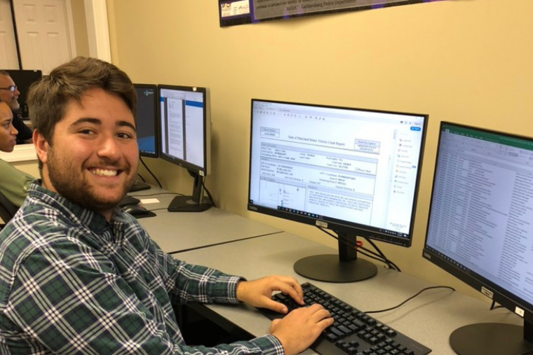
The GIS program at Washington College was established by Dr. John Seidel and Dr. Wayne Bell back in 2003, and is currently led by Director Erica McMaster. GIS provides students with professional training for their future careers, and real-world experiences through internships. Because GIS is completely self-funded, the program relies on grants and contracts from outside organizations. By then hiring student interns to support these funded projects with partners and clients all throughout the United States, the GIS Program teaches data analysis, functional mapping, and the use of geospatial technology through experience.
For example, GIS has been doing grant work for the Maryland Department of Transportation for over a decade, and this fall was awarded over $650,000 for continued support of two grants focused on traffic records improvement and impaired driving mapping and analysis. This is critical work that is helping to make Maryland roadways safer, and it is being done by Washington College students.
Dedicated student interns like Robertson and St. Clair take that charge personally, as their families and hometowns have been directly affected by car accidents.
“I work on the Maryland Highway Safety Office (MHSO) grant, so a lot of the work I do involves mapping DUI's and impaired driving,” St. Clair said. “I had a family member that was hit by a drunk driver - he thankfully survived - so I really like being a part of the force to reduce the number of impaired drivers on the road.”
According to McMaster, it's really about using data to make the best decisions on how to apply limited resources, such as manpower. The interns are doing all of the work – identifying risk areas, running algorithms, putting data into a usable format to determine where to deploy those resources, and even in some cases, communicating the findings to the partner agency contacts. “The students are gaining valuable skills that they can then apply to really any discipline,” she said. This includes learning about GIS Data Management and collection, gaining project management experience, all the way through to client communication, and problem-solving techniques.
“During my sophomore and junior year, I was working specifically on the city of Aberdeen, Maryland, looking at all of their data, and just organizing that by quarters and providing that to the Aberdeen Police Department so that they could monitor those areas or make any infrastructure changes,” Robertson said.
“This data helps a partner like the Aberdeen PD look at problems and make data-driven decisions, not assumption-based decisions,” said McMaster. “In this way, they can focus on the areas of highest need.”
It's not just the impact of the work that makes the GIS program so appealing to students like Robertson and St. Clair – it's the creative freedom; it's the flexibility; it's the hands-on experience; it's what it means within their local communities; it's the people they work alongside – all of it blends to create an unforgettable experience. And prior experience with GIS is not required because all interns go through a training program. What the program staff mostly look for is an interest in technology and location analysis tools.
“I didn't have any GIS experience, and that was one of the really nice things – I came in very honest during my interview, and the program and the leaders there said, ‘we'll train you,'” Robertson said. “I did the paid internship as a freshman and it just kind of stuck.”
Interns continue to rise through the ranks with time, earning higher titles as they gain experience. Both Robertson and St. Clair are now Journeyman Leaders. “Since I've been working here going on three years, I've been put in more leadership positions with more creative freedom, and I love it,” said St. Clair.
As their undergraduate careers begin to close, Robertson and St. Clair – both Environmental Science majors - want to continue their work in this field after college. Their passion for this work runs deep and both see the value in carrying this work through. That's no surprise to McMaster, who pointed out that GIS is a natural supplement for a liberal arts education. “Students are learning problem-solving techniques, along with the tools to implement them,” she said. "Interns with GIS take with them a very valuable skill set."
“I would 100 percent recommend a GIS internship to any student. It's such a supportive, fun environment to work in and it was definitely one of the best choices I've made during my time at this school,” St. Clair said. “The staff and students are so incredibly helpful and will assist you as much as you need. It's the least judgmental place I've ever worked at, as they will answer any questions you have, explain anything you don't understand, hold your hand as much as you need, or let you work independently.”
On November 17 from 10 AM to 4 PM, GIS will celebrate with “GIS Day” to highlight the vital aspects of the program's work and how it impacts the communities they serve. Visitors to the booth are being asked to complete this survey: https://arcg.is/19485r and then view the live results on the big screen!